Early-stage exploration property in northern Saskatchewan's Flin Flon geological domain. 5,240 hectares prospective for VMS and structurally controlled gold mineralization.
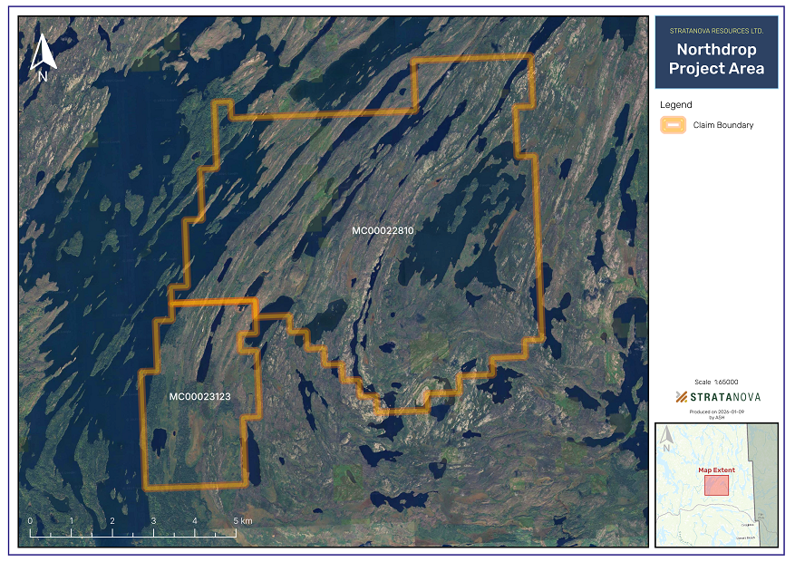
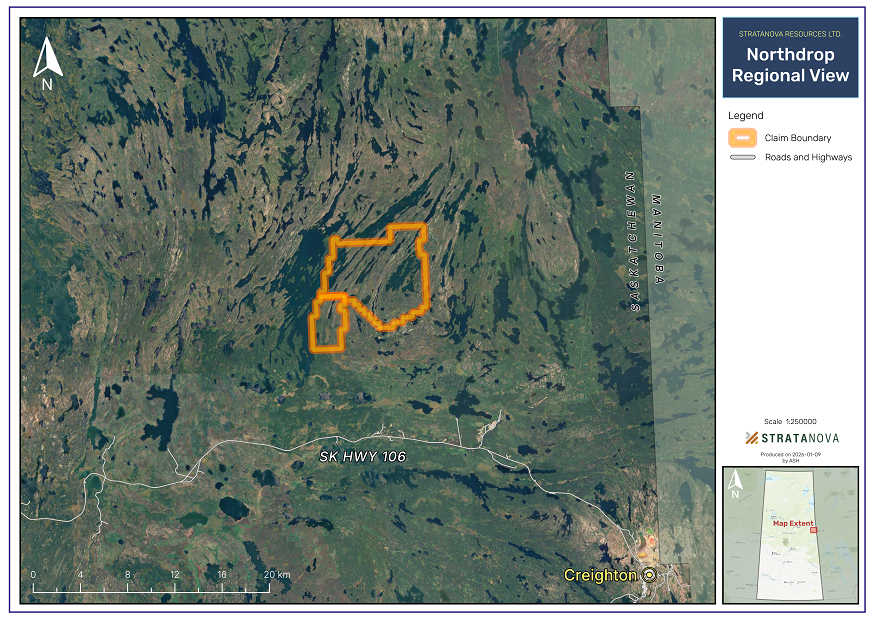
StrataNova holds a 100% interest in a mineral claim located in northern Saskatchewan that is in good standing until November 3, 2027. The claim covers approximately 5,240 hectares and is situated within a geological region that has historically hosted volcanogenic massive sulphide (VMS) and structurally controlled gold mineralization. Satellite analysis completed in Fall 2025 indicates promising structural features and rationale for continued exploration at targeted sites.
Saskatchewan continues to stand out as a leading jurisdiction for mining investment, ranking first in Canada and seventh globally on the Fraser Institute's 2024 Investment Attractiveness Index, which combines assessments of mineral potential and public policy factors such as taxation, regulatory certainty, and permitting. Surveyed mining companies consistently score Saskatchewan highly for its strong policy environment, including stable regulations, quality legal systems, and skilled labour availability, making it one of the most attractive places in the world for exploration and mining investment.
The property is at an early stage of exploration. No mineral resources or mineral reserves, as defined under National Instrument 43-101, have been identified on the property, and there has been insufficient exploration to define any such resources.
Historical exploration work on the property is limited and includes:
Note: Historical exploration data are considered incomplete by modern standards and have not been verified by StrataNova. As such, these data should not be relied upon as an indication of current mineral potential.
| Location | Northern Saskatchewan |
| Claim Numbers | MC00022810 & MC00023123 |
| Property Size | ~5,240 hectares |
| Ownership | 100% StrataNova |
| Claim Status | Good standing until Nov 2027 |
| Geological Domain | Flin Flon (Paleoproterozoic) |
| Mineralization Types | VMS, structurally controlled gold |
| Exploration Stage | Targeted soil sampling |
The property is located within the Flin Flon geological domain, a well-known Paleoproterozoic volcanic belt in central Canada. This geological environment has historically been associated with VMS-style mineralization as well as structurally controlled gold occurrences elsewhere in the region.
Geological observations relevant to the property include:
The presence of these features indicates that the property may be prospective for base and precious metal mineralization. However, their presence does not confirm that mineralization exists on the property in economic quantities.
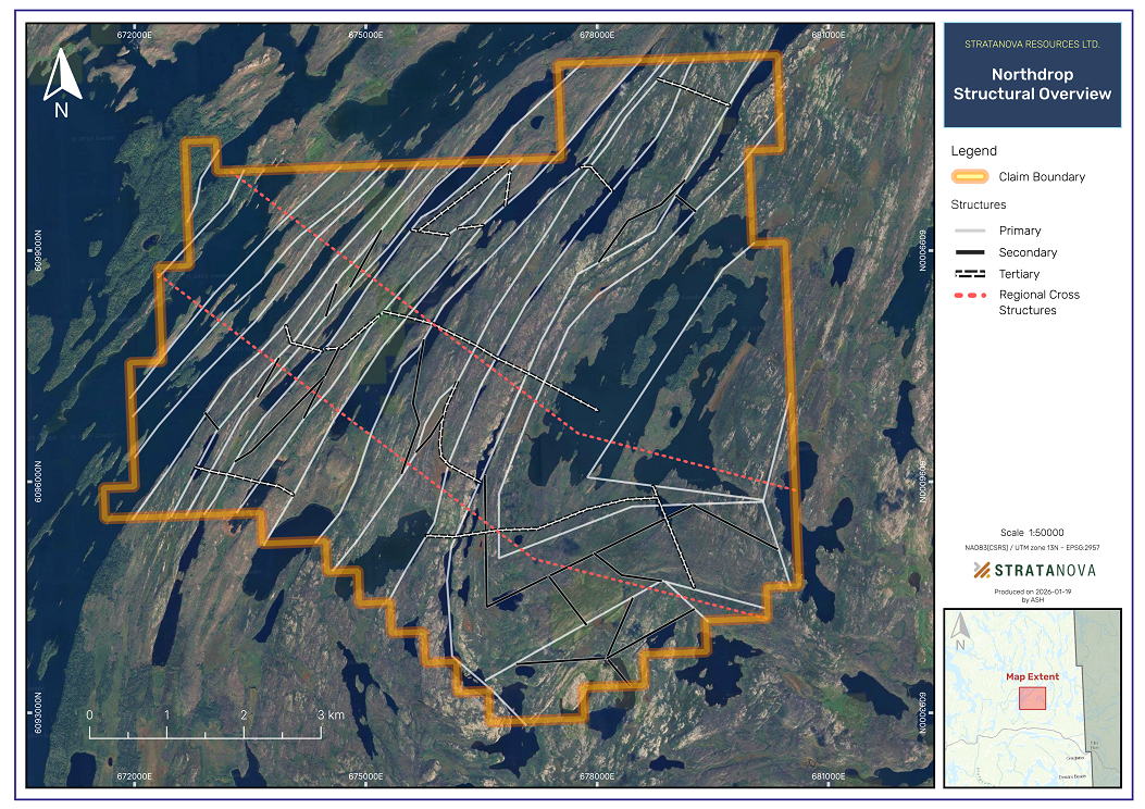
Preliminary satellite-based structural analysis has identified significant structural features across the property, including fault intersections and lineament terminations that commonly serve as controls for mineralization. These structural trends are consistent with regional geological patterns known to influence gold and VMS-style mineralization in the Flin Flon belt.
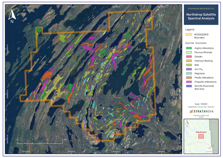
StrataNova completed a preliminary satellite-based spectral and structural analysis over its 52 km² Flin Flon-area property in northern Saskatchewan. The work was conducted by Axiom Exploration Group, an experienced geoscience and remote sensing consultancy, and represents an early-stage, cost-effective step in systematically advancing the property toward drill-ready targets.
The study integrated multi-sensor satellite data (Sentinel-1, Sentinel-2, ASTER, and supplemental datasets) with proprietary processing techniques to evaluate surface mineralogical and structural indicators associated with gold and related rare earth element (REE) mineralization.
Key components included:
This approach allows large areas to be evaluated rapidly while focusing follow-up work on the most prospective zones.
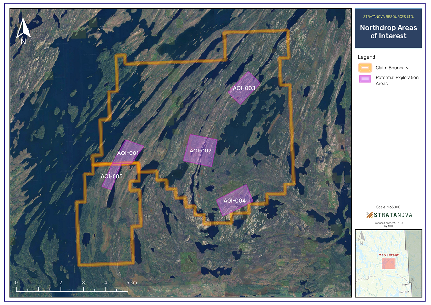
The analysis identified four priority target zones across the property where multiple favorable indicators coincide:
Importantly, these targets represent concentrated, high-priority zones, significantly reducing the footprint and cost of subsequent field programs.
This work provides several key advantages:
Based on the results, Axiom recommends a phased follow-up exploration program focused on the four priority zones:
Note: The spectral analysis represents a preliminary assessment. Ground truthing and additional exploration work are required to confirm the presence and economic viability of any mineralization.
StrataNova's exploration rationale is based on:
Exploration activities are conceptual in nature and are intended to evaluate the property's geological characteristics and assess its potential to host mineralization.
Important: All proposed exploration activities are subject to financing, permitting, logistical considerations, and results from prior work.
There is no guarantee that exploration activities will result in the identification of mineralization or that any targets generated will be suitable for drilling.
Important: Investors should be aware that mineral exploration is speculative in nature and involves a high degree of risk.
This website contains forward-looking statements regarding proposed exploration activities and potential outcomes. These statements are based on management's current expectations and assumptions and are subject to risks and uncertainties. Actual results may differ materially from those anticipated. Readers are cautioned not to place undue reliance on forward-looking statements.
Download our comprehensive investor presentation for additional technical details, maps, and corporate information.